Richey Dr - Port Richey Multi Family Development Land
This feature is unavailable at the moment.
We apologize, but the feature you are trying to access is currently unavailable. We are aware of this issue and our team is working hard to resolve the matter.
Please check back in a few minutes. We apologize for the inconvenience.
- LoopNet Team
thank you

Your email has been sent!
Richey Dr - Port Richey Multi Family Development Land
19.75 Acres of Commercial Land in Port Richey, FL 34668


Executive Summary
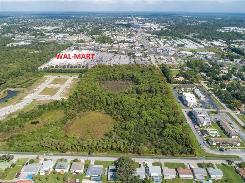
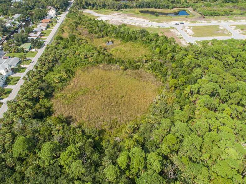
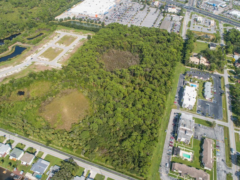
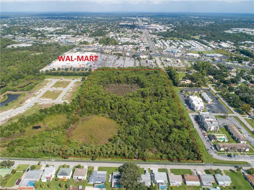
19.75 acres (MOL) within the City of Port Richey, Pasco County, Florida. The property is predominantly composed of tall pine forest with several natural ponds scattered throughout the parcel. City water and sewer utilities run parallel to the eastern boundary. A sewer lift station is located to the NW corner of the property within the Old Post Road right-of-way. Dimensions are +/- 1,301’ north/south x 661’ east/west.
ZONING
Currently zoned as R-3 the parcel has potential to revert to R-1 for higher density. Port Richey’s current Comprehensive Plan indicates that the city shall “guide and control the development of underdeveloped residential land through the rezoning process so as to ensure the provision of a balanced range of housing types to meet the needs of the existing and future population.” With this modification, maximum density could allow 18 units per acre.
LOCATION
Subject property lies to the west of US Highway 19 at Ridge Road, on the corner of Richey Drive and Wilkins Street. Subject Parcel #29-25-16-0000-00400-0000 is adjacent to Super Walmart to the east and Old Post Road to the west. Highway 19 is a major north/south artery within western Pasco County. Ridge Road is a east/west artery which currently extends to the Suncoast Parkway, leading toward Tampa to the south and Citrus County to the north.
Area residents enjoy several local parks: Brasher Waterfront Park, Werner Boyce Salt Springs State Park, Port Richey Waterfront Park, and Nicks Park which includes a city boat ramp. Multiple waterfront restaurants are within walking distance, while many city residents enjoy riding golf carts to and from the entertainment district.
Property Facts Under Contract
| Sale Type | Investment | Property Subtype | Commercial |
| No. Lots | 1 | Proposed Use | Multifamily |
| Property Type | Land | Total Lot Size | 19.75 AC |
| Sale Type | Investment |
| No. Lots | 1 |
| Property Type | Land |
| Property Subtype | Commercial |
| Proposed Use | Multifamily |
| Total Lot Size | 19.75 AC |
1 Lot Available
Lot
| Lot Size | 19.75 AC |
| Lot Size | 19.75 AC |
PROPERTY TAXES
| Parcel Number | 29-25-16-0000-00400-0000 | Improvements Assessment | $0 CAD |
| Land Assessment | $378,029 CAD | Total Assessment | $378,029 CAD |
PROPERTY TAXES
Parcel Number
29-25-16-0000-00400-0000
Land Assessment
$378,029 CAD
Improvements Assessment
$0 CAD
Total Assessment
$378,029 CAD
zoning
| Zoning Code | R-3 (moderate density residential) |
| R-3 (moderate density residential) |
1 of 15
VIDEOS
3D TOUR
PHOTOS
STREET VIEW
STREET
MAP
Presented by

Richey Dr - Port Richey Multi Family Development Land
Already a member? Log In
Hmm, there seems to have been an error sending your message. Please try again.
Thanks! Your message was sent.


