This feature is unavailable at the moment.
We apologize, but the feature you are trying to access is currently unavailable. We are aware of this issue and our team is working hard to resolve the matter.
Please check back in a few minutes. We apologize for the inconvenience.
- LoopNet Team
thank you

Your email has been sent!
Mount Hindrance Ln
57.5 Acres of Residential Land in Chard TA20 1FF


Investment Highlights
- Edge of town greenfield development site
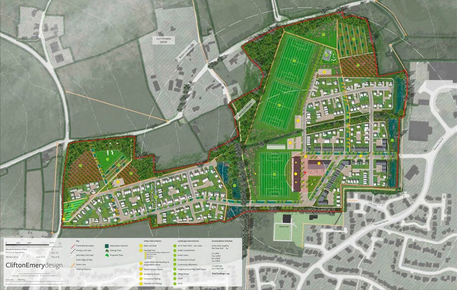
- Pending outline planning permission for up to 295 dwellings
- Approximately 1 mile north of Chard town centre
Executive Summary
The closing date for submission of offers will be confirmed in the Bid Submission Document in the Data Room.
Property Facts
| Sale Type | Investment | Property Type | Land |
| Sale Conditions | Redevelopment Project | Property Subtype | Residential |
| Tenure | Freehold | Total Lot Size | 57.50 AC |
| No. Lots | 1 |
| Sale Type | Investment |
| Sale Conditions | Redevelopment Project |
| Tenure | Freehold |
| No. Lots | 1 |
| Property Type | Land |
| Property Subtype | Residential |
| Total Lot Size | 57.50 AC |
1 Lot Available
Lot
| Lot Size | 57.50 AC |
| Lot Size | 57.50 AC |
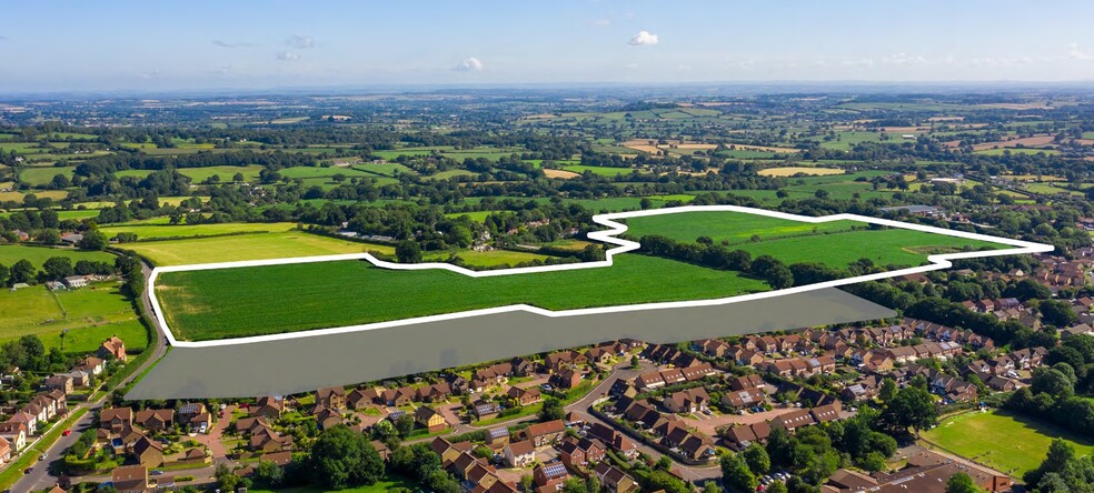
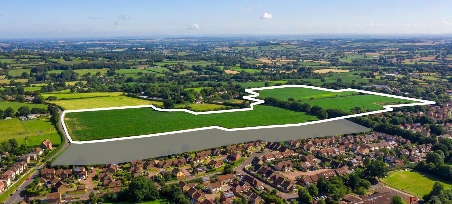
The extent of the land for sale is identified edged red on the adjacent Location Plan and the Masterplan on Page 4. The site area is approximately 23.3 hectares (57.5 acres).
Description
The land is currently in agricultural use and comprises three irregular shaped fields. The southern boundary adjoins residential uses and Chard Bowls Club at the eastern end and the recently completed ‘Blackdown Heights’ residential development at the western end. The western boundary abuts Crimchard, which is an adopted highway and the eastern boundary borders Chard Business Park. To the north, the edge of the site is defined by the hamlet of Cuttiford’s Door and parts of the northern boundary adjoin the public highway that connects Crimchard to the A358. The site is located on the northern edge of Chard, approximately 1 mile from the town centre. It is accessed off Thorndun Park Drive, which is the principal road through Chard Business Park and connects directly with the A358, approximately 400m from the site’s access. The A358 provides access to Taunton to the north-west and Axminster to the south. A range of amenities and services are located within close proximity of the site, including a primary school and a garden centre. Bristol International Airport is located approximately 59 miles to the north-east and provides scheduled and chartered flights to a range of national and international destinations.
Presented by

Mount Hindrance Ln
Hmm, there seems to have been an error sending your message. Please try again.
Thanks! Your message was sent.


